Black Hills South Dakota BDR-X

Map not loading? Visit our Main Interactive Map. For best performance and experience, use the latest web browser version of Microsoft Edge or Firefox. We are currently troubleshooting technical issues with Chrome.

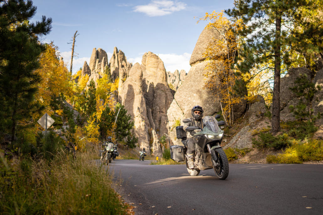
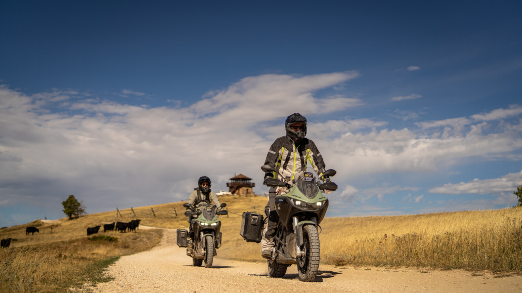
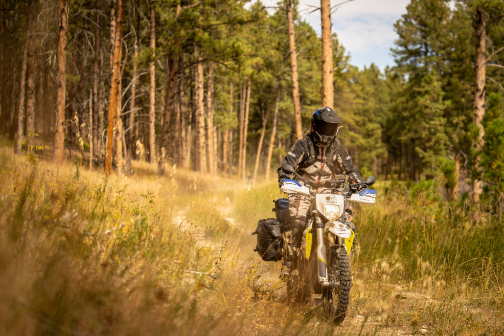
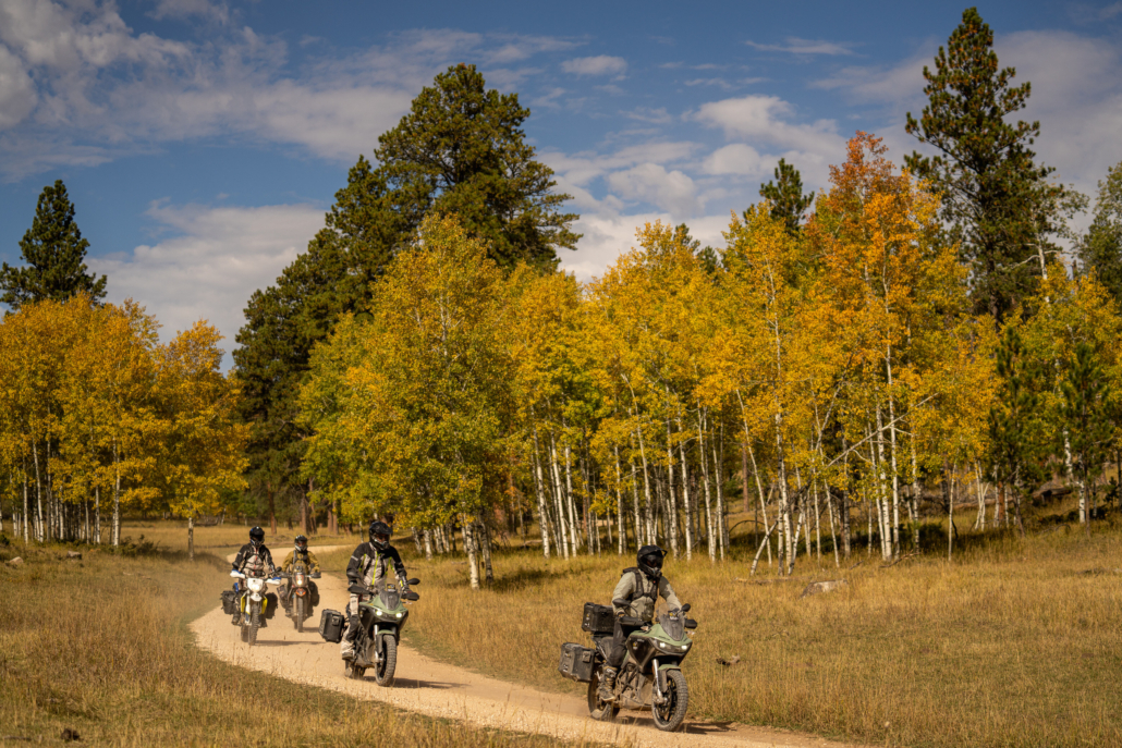
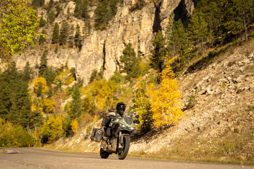
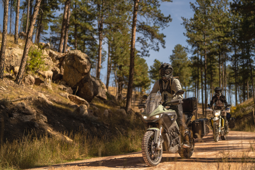
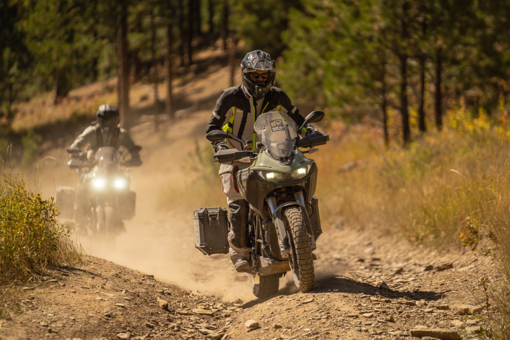
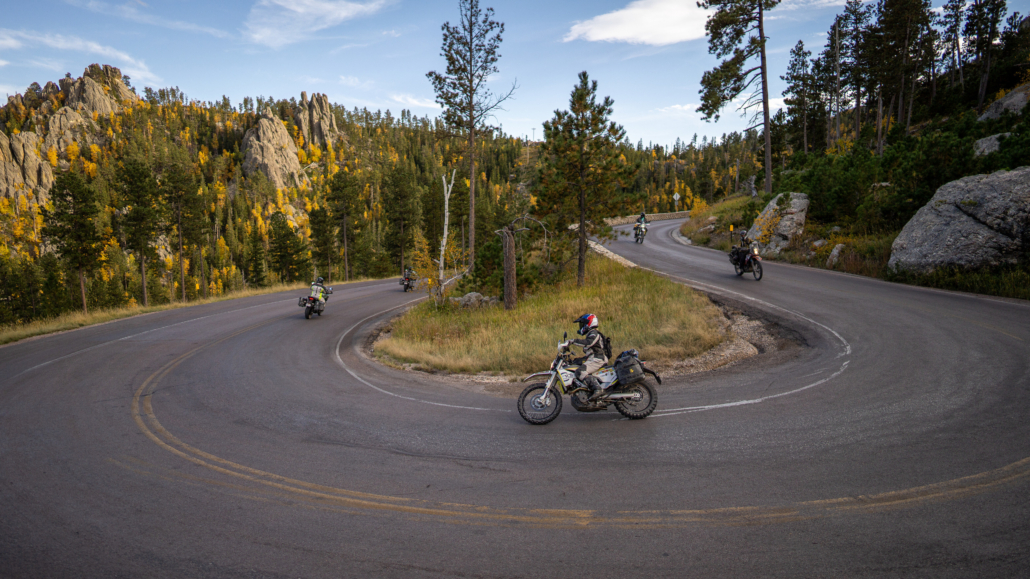
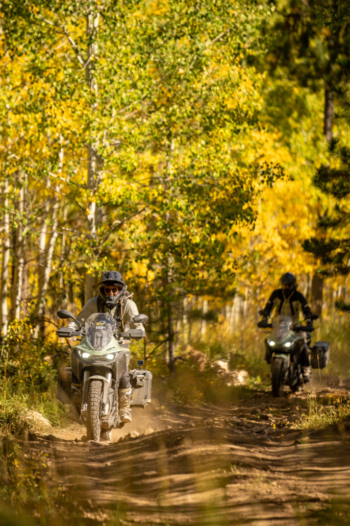
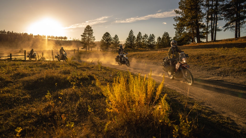
The Black Hills BDR-X is the perfect introduction to a BDR in the midwest.  With striking landscapes ranging from wide-open prairie, dense pine forests, and tall aspen trees, this 355-mile loop comprises three distinct sections and encompasses all the elements for your next adventure.  

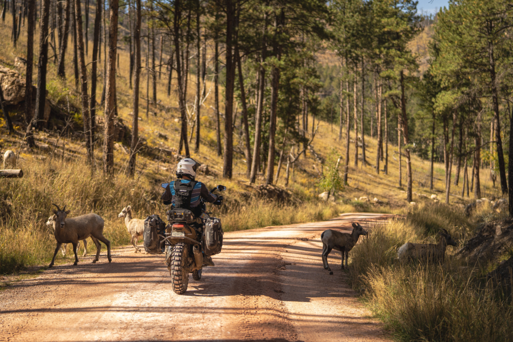
Enjoy a plethora of gravel and dirt roads, challenging two-track, and some of the best pavement you’ve ever ridden as you make way through historical towns in an area that shaped the west.

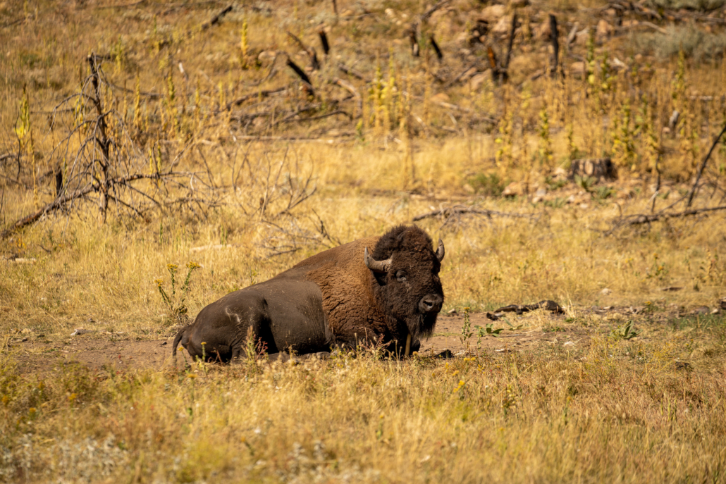
Mount Rushmore, Needles Highway, Iron Mountain Road, Spearfish Canyon, Cement Ridge Lookout Tower, and the Custer Wildlife Loop are some of the many incredible features dotting the landscape of this scenic route.

BLACK HILLS – SECTION DESCRIPTIONS

Section 1: Keystone to Spearfish – 93 Miles

Start your journey in Keystone, SD, a great place to explore the many tourist attractions before departing on your journey.  Almost immediately, you’ll be greeted with a rugged stretch of dirt road through tall pine forests.  Meandering through the woods, top out at Pactola Reservoir for a great view before getting back on the dirt.  After a short section on some primitive two-track, you’ll cruise through the forest, off and on the pavement as you get even deeper into the hills.  

Take a rest at the Nemo Country Store for a snack, then enjoy a mixture of fast, flowing gravel roads into the historic mining towns of Lead and Deadwood.  Famous for lawlessness of the wild west and the town where Wild Bill Hickok was killed on August 2, 1876, Deadwood now offers great lodging and food on the historic downtown main street.  

Take a spin up to the Mt. Roosevelt Friendship Tower where a short hike will take you to incredible views of the tower before dropping back to Deadwood.  Your last stretch north includes gravel switchbacks and rustic homes before settling into the town of Spearfish.  This town provides multiple opportunities for food, fuel, and lodging and is another convenient access point to the route.

Section 2: Spearfish to Hill City – 109 Miles

Immediately after leaving Spearfish, get ready for one of the best stretches of pavement in the country.  Spearfish Canyon Road twists and turns as it meanders along the creek, full of towering cliffs and waterfalls, and is particularly scenic in the fall.

Stop at Spearfish Canyon Lodge for fuel and a bite to eat, hike to the waterfalls, or extend your first day and stay here for the night.  Back on the dirt, this next section passes through towering canyon walls, famously known in Hollywood as the filming location for the final scene in Dances With Wolves.  

After making way through the canyon amidst endless aspen forests, take the scenic climb up to the Cement Ridge lookout tower; welcome to Wyoming!  After admiring the view, the route takes you back down the hill through expansive pine forest before swinging by the Trailshead Lodge, another great stop for food, fuel or even a place to stay.

You’ll quickly get back on the dirt heading south through flowing gravel, then a short rocky downhill section as you get further into the remote forest.  Riding on tight two-track alongside a creek, pass by the Castle Creek campground before a quick detour to the Rochford Mall for a sasparilla, and the ghost town of Mystic.

The final stretch of Section 2 is full of remote forest roads and endless scenery along creeks and lakes, and be sure to take a side trip to the viewpoint overlook before descending into Hill City.

Section 3: Hill City to Keystone – 153 Miles

Section 3 starts in the town of Hill City, another iconic South Dakota town, featuring great restaurants and attractions.  You’ll quickly get onto dirt after leaving town, where the route gives you the option to take the optional Harder track up Bear Mountain or stay on the main route for an easier bypass.  Bear Mountain is a rocky and tight stretch of two-track with a constant climb through dense aspen forests, and would be particularly challenging when wet.  The reward as you summit is Bear Mountain lookout tower, where you can climb to the top for great views.  If you take the easier option, you can backtrack to the tower, and it’s worth the effort.  

Heading south and further into the National Forest, this next stretch is full of fast gravel roads, before turning into some of the most remote sections of two-track and a highlight section on the route.  

Passing through Pringle, head east and stop at Wind Cave National Park before the route takes you north.  As you enter this area of the Hills, you’re now in Custer State Park territory and will need a park pass. Grab one at the entrance station before starting the Wildlife Loop where you’re sure to see bison, burros, and even bighorn sheep on this great stretch of pavement and prairie dirt roads.

Stop at Blue Bell Lodge for gas and a great bison burger, and get ready for some of the best pavement in the country!  After a few stretches on and off gravel, the remaining part of the route is all paved, and includes the iconic Needles Highway, a stop at Mount Rushmore, and the grand finale on Iron Mountain Road and back to Keystone.

WATCH THE TRAILER

DOWNLOAD THE MAP

The latest version of this map is dated: July 2023

BLACK HILLS LODGING

Upscale hotel with wonderful rooms, restaurant and remote setting with close access to downtown Keystone and nearby Hill City.

Address: 434 Old Hill City Rd, Keystone, SD 57751

Phone: (605)857-8805

Visit Website »

Rustic basic motel with good service and close walking distance to downtown Keystone.

Address: 320 Cemetery Rd, Keystone, SD 57751

Phone: (605)-666-4483

Visit Website »

Rustic glamping tents near the start and end of the route

Address: 24342 Presidio Rnch Rd, Keystone, SD 57751

Phone: (888)-496-1148

Visit Website »

Standard hotel with ample parking, breakfast, and close proximity to downtown.

Address: 321 Swanzey St, Keystone, SD 57751

Phone: (605)-666-4925

Visit Website »

Standard hotel with ample parking, breakfast, and close proximity to downtown.

Address: 206 Cemetery Rd, Keystone, SD 57751

Phone: (605)-666-4599

Visit Website »

Basic motel lodge with great restaurant on property, just outside of Keystone.

Address: 24125 US-16A, Keystone, SD 57751

Phone: 1-800-321-0692

Visit Website »

Cabins in a remote setting just a few miles from downtown

Address: 1315 Old Hill City Rd, Keystone, SD 57751

Phone: (605)-666-5475

Visit Website »

Address: 901 Echo Valley Rd, Keystone, SD 57751

Phone: (605)519-9920

Visit Website »

Address: 23165 Horsemans Ranch Rd, Rapid City, SD 57702

Phone: (605)-574-4477

Historic building with close access to downtown Lead and downtown Deadwood

Address: 215 W Main St, Lead, SD 57754

Phone: (605)-584-1112

Visit Website »

Rustic historic building with old west feel and restaurant saloon.

Address: 305 W Main St, Lead, SD 57754

Phone: (719) 250-6555

Visit Website »

Address: 395 Glendale Dr, Lead, SD 57754

Phone: (605)-584-2000

Visit Website »

Historic building in the middle of downtown Deadwood

Address: 27 Deadwood St, Deadwood, SD 57732

Phone: (605)-717-2585

Visit Website »

Historic hotel in downtown Deadwood

Address: 33 Deadwood St, Deadwood, SD 57732

Phone: (605)-722-3456

Visit Website »

Rustic historic hotel on Main Street downtown

Address: 633 Main St, Deadwood, SD 57732

Phone: (605)-578-1745

Visit Website »

Large hotel with restaurant and gaming, just outside of town

Address: 100 Pine Crest Lane, Deadwood, SD 57732

Phone: 1-877-393-5634

Visit Website »

Modern luxury cabins with close access to downtown Spearfish

Address: 514 W Mason St, Spearfish, SD 57783

Phone: (605)-646-0763

Standard accommodations in Spearfish.

Address: 540 E Jackson Blvd, Spearfish, SD 57783

Phone: (605)-642-7795

Visit Website »

Fantastic rustic lodge with riverside rooms, bar, and restaurant with close access to hiking.

Address: 10619 Roughlock Falls Rd, Lead, SD 57754

Phone: (605)-584-3435

Visit Website »

Rustic cabin rooms with restaurant on site

Address: 22075 US-85, Lead, SD 57754

Phone: (605)-584-3464

Visit Website »

Updated classic motel with new ownership and close access to downtown

Address: 580 E Main St, Hill City, SD 57745

Phone: (605)-574-2582

Visit Website »

Cabins tucked away within walking distance of downtown

Address: 320 Park St, Hill City, SD 57745

Phone: (605)-574-4900

Visit Website »

Cabins within walking distance of downtown

Address: 12630 Robins Roost Rd, Hill City, SD 57745

Phone: (605)-574-2252

Visit Website »

Rustic cabins and lodge with restaurant

Address: 25453 SD-87, Custer, SD 57730

Phone: (605)-255-4531

Visit Website »

Historic lodge with rooms and easy access to the route and historic areas.

Address: 24572 SD-87, Custer, SD 57730

Phone: (605)-574-2561

Visit Website »

Address: 12620 SD-244, Hill City, SD 57745

Phone: (800)-562-8503

Visit Website »

BLACK HILLS FOOD

Upscale restaurant with great steaks

Address: 24125 US-16A, Keystone, SD 57751

Phone: (800)-321-0692

Great restaurant with steaks and more on the historic boardwalk

Address: 124 Winter St, Keystone, SD 57751

Phone: (605)-666-4404

The name says it all!

Address: 212 Winter St, Keystone, SD 57751

Phone: (605)-666-4122

Great pizza in 50’s style restaurant on the boardwalk downtown

Address: 110B Winter St, Keystone, SD 57751

Phone: (605)-666-4313

Great rest stop for burgers and ice cream near Pactola Reservoir in section 1

Address: 22493 US-385, Deadwood, SD 57732

Phone: (605)-341-6772

Convenience store with food, grocery supplies and picnic area.  Also now serving full menu with pizza, salads, and a bar.

Address: 12724 Nemo Rd, Nemo, SD 57759

Phone: (605)-578-1438

Rustic eats in a historic saloon setting

Address: 305 W Main St, Lead, SD 57754

Phone: (719)-250-6555

American food in a modern barn setting

Address: 209 Glendale Dr, Lead, SD 57754

Phone: (605)-639-5322

American food in a modern barn setting

Address: 647 Main St, Deadwood, SD 57732

Phone: (605)-645-6419

Upscale eatery in the heart of downtown Deadwood

Address: 677 Main St, Deadwood, SD 57732

Phone: (605)-578-1555

Large resort and casino with multiple restaurants inside

Address: 360 Main St, Deadwood, SD 57732

Phone: (605)-578-1500

Great pub food and beer in a modern setting near downtown Spearfish

Address: 539 W Jackson Blvd, Spearfish, SD 57783

Phone: (605)-717-1255

Good ‘ol American diner with great breakfast

Address: 447 N Main St, Spearfish, SD 57783

Phone: (605)-559-0366

Longstanding American diner in the heart of downtown

Address: 608 N Main St, Spearfish, SD 57783

Phone: (605)-722-2554

Great Mexican food in downtown Spearfish

Address: 117 E Illinois St, Spearfish, SD 57783

Phone: (605)-722-8226

Great American restaurant tucked away next to Spearfish Canyon Lodge for breakfast and dinner.

Address: 10619 Roughlock Falls Rd, Lead, SD 57754

Phone: (605)-584-3333

American food with plenty of dining area

Address: 22075 US-85, Lead, SD 57754

Phone: (605)-584-3464

Incredible steaks and dessert, but be prepared for a long wait.  It’s worth it.

Address: 133 Main St, Hill City, SD 57745

Phone: (605)-574-2749

American diner with hearty breakfasts in downtown

Address: 209 Main St, Hill City, SD 57745

Phone: (605)-574-4582

Great steaks in a historic setting

Address: 301 Main St, Hill City, SD 57745

Phone: (605)-574-2959

Great pizza, drinks, and appetizers in downtown

Address: 158 Museum Dr, Hill City, SD 57745

Phone: (605)-574-2564

Great American pub food and burgers in downtown Pringle

Address: 421 Northern St, Pringle, SD 57773

Phone: (605)-673-2697

Great restaurant serving bison burgers and steaks, located within Blue Bell Lodge

Address: 25453 SD-87, Custer, SD 57730

Phone: (605)-255-4531

Food and ice cream within Mt Rushmore Natl Memorial

Address: 13000 SD-244, Keystone, SD 57751

Phone: (605)-574-2515

BLACK HILLS FUEL

Address: 424 US-16A, Keystone, SD 57751

Phone: (605)-666-5203

Nemo Country Store and Mercantile

Address: 12724 Nemo Rd, Nemo, SD 57759

Phone: (605)-578-1438

Address: 514 W Main St, Lead, SD 57754

Phone: (605)-584-3221

Address: 157 Charles St, Deadwood, SD 57732

Phone: (605)-578-1857

Address: 95 Sherman St, Deadwood, SD 57732

Phone: (605)-578-2479

Address: 402 Main St, Deadwood, SD 57732

Phone: (605)-578-1110

Address: 820 E Colorado Blvd, Spearfish, SD 57783

Phone: (605)-642-4793

Address: 2615 E Colorado Blvd, Spearfish, SD 57783

Phone: (605)-642-2041

Address: 10620 Roughlock Falls Rd, Lead, SD 57754

Phone: (605)-584-3435

Address: 22075 US-85, Lead, SD 57754

Phone: (605)-584-3464

Address: 201 Main St, Hill City, SD 57745

Phone: (605)-574-2077

Address: 632 Main St, Hill City, SD 57745

Phone: (605)-574-9001

Address: 25453 SD-87, Custer, SD 57730

Phone: (605)-255-4531

BLACK HILLS MOTORCYCLE DEALERSHIPS

BLACK HILLS PACKING LIST

This packing list serves as an example and is not intended to be a complete list for your backcountry riding needs. Feel free to customize this list to work for you.

  • Helmet
  • Boots
  • Goggles
  • Gloves (2 sets)
  • Protective gear (pressure suit, Leatt brace, knee braces)
  • Jacket
  • Pants
  • Balaclava or neck gaitor
  • Water bladder or bottle
  • Hydration pack
  • Ear plugs

FREQUENTLY ASKED QUESTIONS

Below are answers to some of the Frequently Asked Questions about the Black Hills South Dakota BDR-X.

The Black Hills BDR-X is a 355 mile route through the Black Hills National Forest and Custer State Park in South Dakota, USA.  Featuring incredible pavement, gravel roads, rugged two-track, and a never-ending supply of historical and scenic waypoints, this route can be accomplished in about 3 days, but extend your stay and see what else the Black Hills has to offer.

This route is best done late May through early October.  Lingering patches of snow and ice can be found in the spring, and temperatures start to drop in late fall. 

Be aware of events in the area, including the Sturgis Motorcycle Rally, which fills the area with up to a million riders and can be extremely congested.
This years’ rally takes place August 4-13, 2023.
https://www.sturgismotorcyclerally.com/

As with all BDR’s, this route is designed for intermediate riders.  Most of the composition is easier gravel and packed dirt, but there are stretches of tight, rugged two-track, rocky hills, and the Optional Harder climb up Bear Mountain.

The Black Hills BDR-X has one dedicated ALT Harder track, on Section 3 just outside of Hill City.

This section includes a rocky two-track climb to the top of Bear Mtn and tops out at the lookout tower.
Riders wishing to remain on the main route can still backtrack to the lookout tower from the west via a gravel road.

May through October are generally predictable, but can see hot temperatures in the middle of summer, and cold mornings and evenings in the shoulder season with potential for frost on the ground.  Rain storms can happen at any time but are more common in early summer.  June is typically the highest rain month.

This route is designed to be ridden counter-clockwise, starting from Keystone, but you can access this loop from any location.  Please be prepared for two-way traffic everywhere on this route and always remember to Ride Right to avoid head-on collisions around blind corners.

This route can be accomplished in three days, roughly one section per day.  This area is full of amazing opportunities for tourist activities, hiking, memorials, monuments, national parks, and historical areas so do yourself a favor and plan to spend some extra time to really enjoy the area.

Yes.  A Custer State Park Pass is required for certain portions of this route, primarily the later half of Section 3, which cannot be avoided.  

A park pass is $8 per day, $20 for 7 days, or $36 for an annual motorcycle pass.

There are several self-pay and manned kiosks throughout the area, and the Wildlife Loop entrance station is the first one you’ll encounter as you ride this route in the recommended direction.  For more information visit: https://gfp.sd.gov/pel/
You will also need to pay a parking pass if you visit Mt Rushmore National Memorial, as well as entrance fees to Wind Cave National Park and other attractions should you choose to visit them.

There are many established campgrounds throughout the route, as well as dispersed camping within the Black Hills National Forest.  Be mindful, campfires are absolutely NOT allowed in the National Forest outside of established campgrounds with dedicated fire rings.

The Black Hills can be very popular during the summer and advanced reservations for lodging and campgrounds is highly recommended.

Campfires are absolutely NOT allowed in the Black Hills National Forest outside of established campgrounds with dedicated fire rings.  Dispersed campfires are not permitted.
For more information click HERE

The longest gap between fuel stops is 100 miles on Section 3 on the route from Hill City to Blue Bell Lodge.  There is the option to take a detour to Custer if fuel is required.  Fuel is fairly widely available on this route but pay special attention to certain areas and never pass gas.  This loop makes it easy to detour from the track to get fuel in a nearby town.

There are plenty of great lodging options available throughout this route.  Additionally, the route can be accessed easily from various towns within the Black Hills.  The most notable locations for lodging opportunities along the route are: Keystone, Deadwood, Spearfish, Spearfish Canyon Lodge, Hill City, Hot Springs, and Custer as well as nearby Rapid City and Sturgis.

This route cannot be ridden without the use of GPS tracks.  Be prepared and bring a navigation device with the latest GPS tracks loaded. Free GPS tracks are available for download on this site. The route can also be navigated using a smartphone GPS navigation app like Gaia, Rever and others. The Black Hills BDR-X expedition documentary film is a great source of information about the route and is available via on-demand video platforms like YouTube and Vimeo. 

Any GPS unit capable of handling 15 track logs with a minimum of 1500 points each is suitable for use on this route. Garmin models that work best for this application are: Zumo XT, Zumo 590/595/395/396, Montana, and 276Cx. Many other GPS units are compatible with the GPX file format, check the owner’s manual of your device for more information.  You can also import the tracks into a GPS navigation app, like Gaia GPS, but make sure you have the premium version of the app, so you can navigate via offline maps.

Cell phone service can be limited in some areas on this route so a satellite communication or tracking device such as Zoleo, Spot, or Garmin InReach is strongly recommended for emergency situations.

Any bike that has a license plate, can run knobby tires, has adequate suspension, can carry the gear you will need, and has enough fuel range. Most adventure or dual-sport motorcycles will be suitable for this trip.  Even very experienced riders on our team reported being challenged on larger bikes by some of the technical sections of the route during the filming expedition. Choose the bike that you are the most comfortable riding in challenging terrain and that you are able to pick up if you drop it.

DOT approved knobby tires are strongly recommended.  Riding this route without at least a 60/40 tire (60% dirt, 40% road) is not recommended.

Segments of this route can be ridden two-up for those experienced in riding off-highway with a passenger and luggage. However, we strongly advise against riding the technical sections of this route two-up.  The pavement portions of this route are a fantastic way to explore with a partner on board.

No. Please don’t go off the route anywhere where it’s gated or signed for seasonal or permanent closures, and don’t venture onto private property. There are many trails in the Black Hills National Forest that are restricted to OHV vehicles only and may not be traveled without this permit.  For more information click HERE

The Black Hills BDR-X route may include a few instances where the track follows an easement road through private land. In many, but not all cases, the land owners have installed “private land” signs and it is important that riders acknowledge these signs and stay on the designated track. If you are unsure of the land ownership adjacent to the roads, such as outside of national forest lands, it’s best to stay on the track to avoid trespassing. In all cases riders should not ride off the roads which creates new trails and damages vegetation. Please remember that riding off the designated roads can jeopardize our right to use these roads for recreation.

Yes, there may be gates and/or barricades along the route. When you encounter gates, leave them as you found them. If they were open, leave them open and if they were closed, close them again after you pass through. If you pass by ranches, be courteous and ride respectfully. In spring and early summer there may be temporary closures when crews are repairing washouts, downed trees, and other road hazards. If roads are closed due to wildfires, do not ride around the signs as that can put you or fire crews in danger and can get you a hefty fine. Check the BDR website for route updates before you go.

Please abide by posted road closure signs. Ignoring these signs is a sure-fire way of getting a road closed for good. That said, sometimes locals will post unofficial “road closed” signs on public roads for their own personal reasons. Additionally, land managers may not have removed a “closed” sign from a seasonal road – even though the sign right next to it clearly displays the open/closed dates. In these cases, use your best judgment – if in doubt navigate around the closed road and report it to BDR. And please remember never to engage in arguments with local land owners.

Each state has its own recreational fishing requirements and restrictions. To learn about the required licenses and stamps for fishing (and hunting) in South Dakota, visit: https://license.gooutdoorssouthdakota.com/Licensing/CustomerLookup.aspx

We do our best to post the most up-to-date information about the route on ridebdr.com/.

We depend on the BDR community to inform us about route and road conditions, so if you encounter any road closures or severe conditions that are worth reporting, please contact us with the information.  For more information to plan for road closures click HERE

South Dakota is a habitat for many animals like deer, pronghorn, bison, burros, bighorn sheep, and mountain goats — all of which make their way to the road at some point. Be alert everywhere you go as animals can and will cross your path along the route – especially at dusk.

Pronghorn are known for wanting to race motorcycles, but don’t encourage them. Slow down as soon as you see animals as, for some reason, they like to cross in front of bikes instead of running away from them. Look out for wild horses when you are in open range land.  Appropriate food practices while camping is an absolute must for your safety and the animal’s safety. 

Buffalo are dangerous animals and should never be approached.  Do not pet the fluffy cows.

Yield to all animals whether wild, domestic, or livestock by slowing down or stopping. Many locals in rural areas keep their dogs off-leash on their property and dogs love to chase motorcycles – be cautious and considerate.

All of the roads used on the BDR-X are public roads and as such, are open to vehicles. If you do decide to drive this route you will want a 4×4 with high clearance as the route has deep puddles, large rocks, ruts and steep, loose grades. Always stay to the right and go slow around blind corners to avoid head-on accidents with others using the roads. We recommend traveling the loop counter-clockwise to minimize head-on traffic.

It is absolutely essential that you Ride Respectfully and follow the tips outlined in our Ride Respectfully campaign.  Remember, it’s up to all of you to preserve our access – we can easily lose access to many of these roads if we don’t practice proper etiquette. Always represent BDR and the ADV community in the best light.

Rating the Routes by Difficulty

We often get requests to provide the difficulty ratings of the BDR. We do not officially rate roads or routes because the difficulty can change from day to day depending on weather, changes in road conditions, and road damage caused by a variety of forces including wind, storms, flooding, snow, logging, forest fires and more.

The difficulty experienced by an individual also depends on their off-road skills, level of fitness, stamina, bike size and amount of weight carried on the bike. For these reasons we can’t provide a rating system like a ski resort or OHV park.

We can help you a bit by ranking the existing Backcountry Discovery Routes from most difficult to least difficult. Here is the list: CABDR-South, NEBDR, AZBDR, WYBDR, UTBDR, COBDR, NVBDR, WABDR, NMBDR, IDBDR, MABDR.

So CABDR-South is the most difficult especially if you ride the expert sections and MABDR is the easiest in general terms. Although MABDR is the easiest there are still a few challenging rocky sections and the several water crossings that can get very difficult if the water is high.

Be sure to also review the FAQ’s for each route and our General FAQs prior to embarking on your trip.

Backcountry Discovery Routes is a 501c(3) non-profit corporation. © 2022 - 2024 Backcountry Discovery Routes, Inc. All rights reserved. Terms of Use.